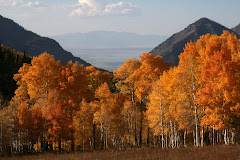
Here are some pictures I took up on the Nebo Loop, south of Payson, Utah. Elevation, according to signs posted on the roadside, was about 9,000 ft.


 This view is looking west down Santaquin Canyon, with the southern tip of Utah Lake visible.

 This is a panorama shot made from several shots and stitched together to form a panorama. It's looking west down Santaquin Canyon from the Nebo Loop Road, south of Payson.
 The aspens are at the peak of their color right now. The maples, in the lower canyons, are probably a little past peak color.


